 vesseltracker.com
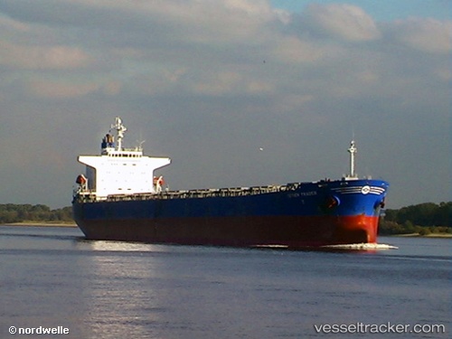
Vessel KHALEJIA ANA 5 IMO: 9221437, MMSI: 372989000 Bulk Carrier
UTC, 28.96093, 48.35912, course: 118, speed: 0
UTC, 28.97272, 48.36183, course: 354, speed: 4.2
2026-02-19 22:20:21 UTC, 29.05800, 48.23751, course: 270, speed: 2.9
Live AIS position:
UTC. Near Mina Abd Allah),
updated 2026-02-19 22:20:21 UTC.
Find the position of the vessel KHALEJIA ANA 5 on the map. The latter are known coordinates and path.
marine traffic ship tracker show on live map
The current position of vessel KHALEJIA ANA 5 is 29.05800 lat / 48.23751 lng. Updated: 2026-02-19 22:20:21 UTCCurrently sailing under the flag of Panama
KHALEJIA ANA 5 built in 2001 year
Deadweight:
73910 tDetails:
Last coordinates of the vessel:
UTC, 28.96118, 48.35926, course: 128, speed: 0UTC, 28.96093, 48.35912, course: 118, speed: 0
UTC, 28.97272, 48.36183, course: 354, speed: 4.2
2026-02-19 22:20:21 UTC, 29.05800, 48.23751, course: 270, speed: 2.9